


With immaculate white sands and crystal clear waters, you might easily mistake some Isle of Mull beaches for a more tropical destination. This illusion usually lasts until you dip your toes into the Atlantic! While the island boasts 300 miles of coastline, it features sweeping bays like the white sands of Calgary or the silver sands of Ardalanish. Many lesser known coves also remain tucked away, well beyond the view of the roadside.
Whether you are staying in the north, east, south or west, you can find a stunning spot to visit. Discover the beautiful Isle of Mull beaches you could explore below.

North Mull
North Mull serves as the most accessible region for anyone seeking the island’s famous coastal beauty. This area is home to the iconic shell sands of Calgary alongside the secluded, quiet coves of Langamull. A scenic loop road dominates the landscape, offering expansive views of the Atlantic and highlighting the small isles that pepper the northern horizon.
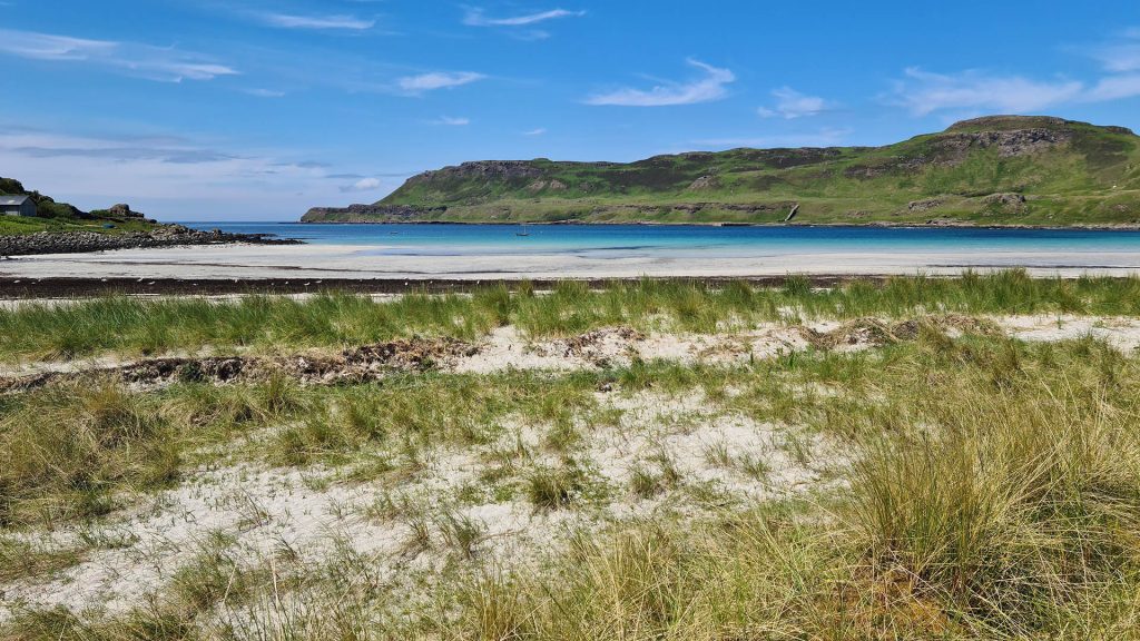
Calgary Bay
Calgary Beach sits on the northwestern coast of the Isle of Mull, approximately 12 miles west of Tobermory along the B8073. Low basalt and metamorphic cliffs frame this iconic bay. The machair, a fertile shell sand grassland unique to the Scottish Highlands and islands, adds a vibrant green border to the shore. The beach is famous for its broad expanse of bright white shell sand and clear, turquoise waters. These elements create a striking contrast against the deep green hills of the Mornish peninsula. Because of its location, the bay serves as the starting point for a superb coastal walk to Caliach Point. Access is easy with parking close by, and visitors will find a campsite area with toilet facilities.
Langamull Beach
Found on the northern coast of the Isle of Mull, Langamull Beach is reached via a 30 minute scenic walk. You can find the path on the forest track between Dervaig and Calgary. Many people refer to this secluded bay as the Caribbean of Mull due to its remarkably clear turquoise waters. Ancient igneous rock formations naturally divide the beach into several small, intimate coves. These provide sheltered spots for visitors even on windier days.

Croig
Arriving into Croig Harbour feels like stepping into a storybook, with just a handful of houses and an old stone fishing pier. Locals still work this pier today, maintaining the island’s traditional fishing heritage. From here, you can explore the coastline to discover several small sandy bays, including Port na Ba. By following a track for about twenty minutes, you will reach this favourite local spot. It is a brilliant vantage point from which to take in the sunset. The walk is gentle and rewards visitors with intimate coves that are far less crowded than the more famous neighbouring bays.

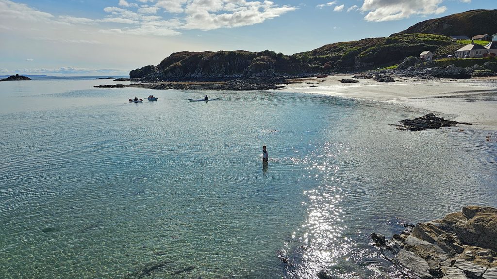
Tobermory Beach
Tobermory Beach sits directly on the iconic harbour front of the island capital. It is located at the southern end of the Main Street near the Ledaig pier. Unlike the remote white sands found elsewhere, stone sea walls and colourful buildings frame this urban beach. The shoreline consists of a mixture of dark sand and shingle that becomes more expansive as the tide recedes. It offers a unique vantage point of the harbour activity and the wooden pier structures from the water level.

Traigh na Cille (Black Beach)
Traigh na Cille is most commonly known as Black Beach. It is located on the northwestern coast of the Isle of Mull near the village of Kilninian. The beach is accessible via a short walk from the roadside near the historic Kilninian Parish Church. This building dates back to 1755 and adds a sense of history to the journey. Known for its namesake dark grey sands, the beach features a striking combination of charcoal shoreline and smooth pebbles. The path descends from the roadside at Torloisk toward the water. In early summer, pink blooms of sea thrift decorate the rocks hugging the sand, while surrounding trees cast light shade over the area.

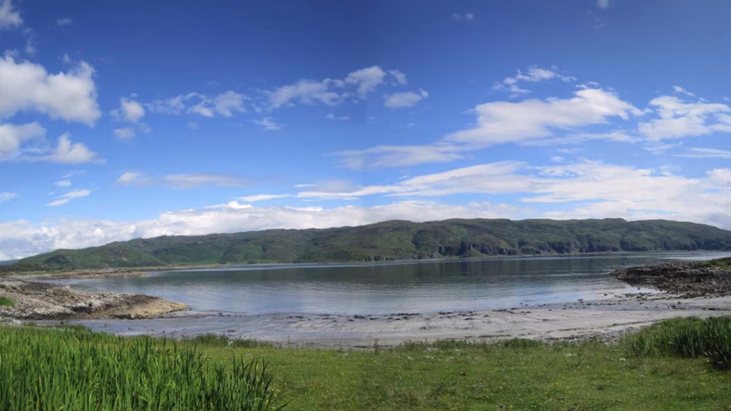
Central and South East Mull
In contrast to the north, this region presents a more dramatic and rugged shoreline defined by dark volcanic sands. History permeates this area, with beaches situated beneath ancient castle ruins or close to prehistoric monuments. Reaching these spots often involves navigating steep coastal roads or traversing large private estates. Although the terrain is more challenging, the striking landscapes make the effort incredibly worthwhile.
Port an Tobire and Port nam Buitsichean
Port an Tobire and Port nam Buitsichean are located on the eastern coast of Mull. They sit nestled beside the imposing ruins of the 13th century Aros Castle. A short walk through the historical grounds, starting from the stone bridge north of Salen, provides easy access. These bays are primarily sandy with patches of shingle. They provide a grounded and ancient feel to the coastal experience.

Gribun Beach
Gribun Beach sits on the west coast of Mull, where the B8035 road runs along the shoreline. It is located at the foot of the colossal Gribun Cliffs. This is one of the most geologically significant areas on the island, featuring dark volcanic shingle and grey sand. The beach is unique because of the massive rolled boulders that have fallen from the cliffs above. Some of these stones are the size of small houses, creating a truly humbling atmosphere.

Duart Beach
Duart Beach is located on the eastern coast of the Isle of Mull. It is situated directly below the historic Duart Castle on the Duart peninsula. A short walk starting at the castle Tea Room easily reaches the beach. This path leads down through grassy slopes to the shoreline. It is a charming and sheltered stretch consisting primarily of grey shingle and dark volcanic pebbles. However, the receding tide often reveals small patches of pale sand.
Laggan Sands
Laggan Sands sits on the rugged southeastern coast of the Isle of Mull at the head of Loch Buie. A single track road leads to the end of the settlement. From there, a short and level walk takes you directly onto the shore. Park beside the shore and treat yourselves to a coffee at The Old Post Office. Afterwards, bear east for the beach. The shore is a vast expanse of pale grey sand. It is unique for its deep charcoal colour which contrasts sharply with the vibrant green machair.

Croggan Beach
Croggan Beach is located on the southeastern coast of the Isle of Mull. It sits at the end of a long and winding single track road that follows the southern shore of Loch Spelve. A twenty minute walk from the small settlement of Croggan reaches the beach. To find it, pass through a gateway that leads out onto the coastline. Tiny waterfalls trickle down the rocks, which primroses pack in spring. It is a quiet and sheltered stretch of shore consisting of fine grey sand, smooth shingle, and large kelp covered rocks.
Port Donain
Port Donain sits on the rugged southeastern coastline of the Isle of Mull. You can access it via a coastal track that leads south from the settlement of Croggan. Fine grey sands and smooth shingle define this remote bay. It tucks into a deep indentation in the rocky metamorphic cliffs. The beach sits at the head of a narrow inlet, providing a highly sheltered environment. This contrasts with the more exposed sections of the Firth of Lorn coastline nearby.

Port a’ Bheoil Mhoir
This is a tidal beach located on the southern coast of the Isle of Mull. It is situated along the wilderness track that connects Lochbuie to Carsaig. A mixture of fine sand and volcanic shingle composes the beach. Meanwhile, the steep, forested slopes of the Lochbuie estate frame the area. Visitors gain access by parking at the designated shorefront area in Lochbuie. From there, follow the coastal path westward for approximately two miles. The shoreline here is particularly notable for its clear waters and dramatic woodland.
Ross of Mull and South Mull
The Ross of Mull is a long granite peninsula stretching west toward Iona. Vibrant pink granite rocks and exceptionally clear turquoise water define the coastline here. Many of the beaches in this region feel remote. Consequently, they require walking through farmland or nature reserves to access. These extra steps ensure that you often have these stunning locations all to yourself.
Fionnphort Beach
Set just below the village at the southwestern tip of Mull, Fionnphort Beach is a broad sandy expanse. It serves as the gateway to the sacred island of Iona. Bright white sands and the iconic split granite boulder located at its centre characterise the beach. Because of its proximity to the ferry pier, it is a very accessible spot. It is perfect for a quick coastal stroll or a picnic with a front row view of the Sound of Iona.

Fidden Beach
Fidden Beach sits on the southwestern tip of the Ross of Mull, just over a mile from Fionnphort. A single track road leads through Fidden Farm, a popular coastal campsite, and provides easy access. Expansive, shallow white sandy bays and pink granite outcrops characterise the beach. These outcrops divide the shoreline into smaller, sheltered coves. Furthermore, as summer arrives, the machair surrounding the beach springs into bloom for a beautiful display.

Knockvologan Beach
Knockvologan Beach sits at the tip of the Ross of Mull, past the villages of Fionnphort and Fidden. It is a vast and intricate stretch of coastline consisting of numerous white sand coves. Large outcrops of pink granite separate these areas. At low tide, the receding waters reveal a massive expanse of sand that connects the mainland to Erraid. This tidal island famously inspired the setting in Robert Louis Stevenson’s novel Kidnapped.

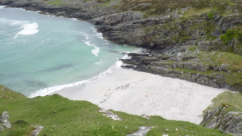
Traigh a’Mhill
Traigh a’Mhill is a small, secluded cove located along the southwestern coast of the Ross of Mull. It sits just south of the larger Knockvologan Beach. This beach is a perfect example of the hidden Mull, offering a quiet sanctuary for explorers. The bay features remarkably clear blue waters. Additionally, these are backed by the vibrant pink granite outcrops that define this geological region.
Ardalanish Beach
Ardalanish Beach sits on the southern coast of the Ross of Mull, approximately two miles from Bunessan. A scenic walk through the fields of Ardalanish Farm reaches the beach. This working organic farm is well known for its native Kyloe cattle and Hebridean sheep. The expansive stretch of coast features remarkably white sands and dark, jagged metamorphic rocks. These rocks form part of Mull’s ancient geological landscape and frame the area beautifully.

Uisken Beach
Uisken Beach is located on the southern coast of the Ross of Mull, near the village of Bunessan. The beach is easily accessible by a narrow road that leads to a small parking area. It is a picturesque, sheltered bay characterised by its fine, pale sand and offshore rocky islets. These rocks protect the inner waters from the full force of the Atlantic, making it a calm spot for visitors.
Kilvickeon Beach
Kilvickeon Beach sits on the rugged southern coast of the Ross of Mull, reached via a rough track. The journey to the shore is notably atmospheric, passing the medieval ruins of Kilvickeon Old Church. A magnificent stretch of white sand characterises the beach. It is famously divided into two sections by a rocky tidal island called Garbh Eilean. A sandy tombolo connects this island to the mainland at low tide, provided the waters are receding.

Dun a’Gheird
Dun a’Gheird is another of the Ross of Mull’s lesser known beaches, situated on the rugged southwest coast. Its name comes from the ancient hill fort perched on the heights nearby. This history adds a layer of prehistoric mystery to the visit. Adventurous visitors who cross the moorland on foot are rewarded by a picturesque bay sheltered by incredible rock formations.
Market Bay (Traigh na Margaidh)
Market Bay is located on the northern coast of the Ross of Mull, between Camus Tuath and Ardfenaig. A thirty minute walk along the track to Camas provides access to the area. The path leads across open moorland toward the coastline. Here, the beach reveals itself as a series of secluded white sandy coves edged by beautiful machair grassland.

Traigh Bhan
Traigh Bhan is a stunning beach on the remote southern coast of the Ross of Mull. It sits beneath the haunting ruins of the abandoned settlement of Shiaba. Accessing this beach requires following the rough gravel track toward Scoor and walking over the hilltops. Best explored at low tide, the beach reveals a broad expanse of white sand. This area was once a vital landing port for the villagers who lived and worked on the cliffs above.
Scoor Beach (Traigh Bhan na Sgurra)
Scoor Beach sits on the rugged southern coastline of the Ross of Mull. A weathered track runs south from the A849 to a small parking area near the Kilvickeon cemetery. From there, a hike across open moorland leads to the cliff tops. The first view of the beach reveals itself from high above. This beach forms a deep, sheltered cove of fine white sand. Finally, steep basalt and metamorphic cliffs embrace it on three sides to provide a dramatic sense of enclosure.

Traigh Ghael
Traigh Ghael is located on the remote southern coast within the Tireragan Nature Reserve. Reaching this beach requires a strenuous hike of approximately two to three hours each way from Fionnphort. This journey takes you through thick heather and boggy terrain. Such isolation ensures that the beach remains one of the most untouched locations on the island. Consequently, it consists of a magnificent stretch of brilliant white sand framed by high cliffs.
Carsaig Beach
Carsaig Beach is located on the southern coast at the end of a steep, winding road from Pennyghael. The beach is a striking departure from the white sands of the west. It is characterised by dark grey volcanic shingle, grey sand, and massive boulders. These rocks sit at the foot of the towering cliffs that rise vertically from the shoreline. Together, they create one of the most imposing coastal landscapes on the island.

Find Your Perfect Coastal Spot
If you are ready to plan your next coastal adventure, you can explore all these locations and more on our interactive map.
Follow the link below to browse our full map listings of Isle of Mull beaches.